
Seismic properties of North America and surrounding oceanic basins
These maps depict the seismic properties of North America and the surrounding oceanic basins. Figure 1 shows the location of data that has been collected for this study. The crustal thickness map was constructed using over 1700 data points (dots), of which more than 1300 are designated continental crust. Figure 2 shows the types of geologic provinces found in North America. These may be compared to the underlying crustal thickness map also shown in Figure 2.
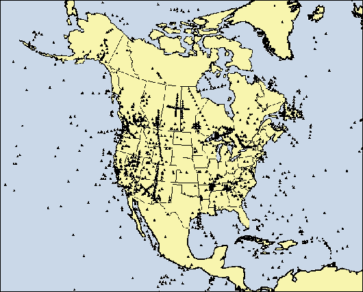
Figure 1. Location of data that has been collected for this study.
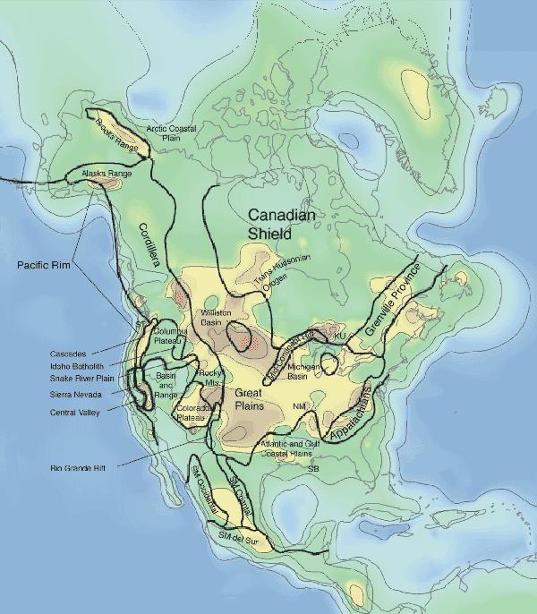
Figure 2. Crustal Thickness in kilometers, derived from a comprehensive compilation of seismic refraction and reflection data, earthquake studies, and surface wave analyses. One feature of this map is an extension of the thin crust of the Basin and Range Province into Western Canada. The contour interval is 10 km; a contour representing 45 km (dashed line) is also included.
Many well-known features are reproduced here, such as the thin crust of the Basin and Range and the thick crust of the US Great Plains and Midcontinent. The map also reveals a number of new features. The thickest crust is beneath Late Proterozoic regions, not the oldest crust (e.g., Superior Province, central and eastern Canada). The map shows 40+ km thick crust beneath the US Cascades, while thin crust is imaged to the north beneath the Canadian Cordillera.
These features were only hinted at in previously published contour maps (Soller et al., 1982, and Allenby and Schnetzler, 1983). In addition, the extent of the continental shelves along the Pacific and Atlantic coasts are more faithfully reproduced in terms of crustal thickness. The average thickness of the North American continental crust, including margins, is 36.5 km ranges from 14 km to 60 km.
Figure 3 presents a map of sub-Moho p-wave velocity (Pn). The average crustal p-wave velocity (Pc) of North America including the sediments is shown in Figure 4. Figure 5 presents the average p-wave velocity of the consolidated or crystalline crust (Pcc) without sediments in North America.
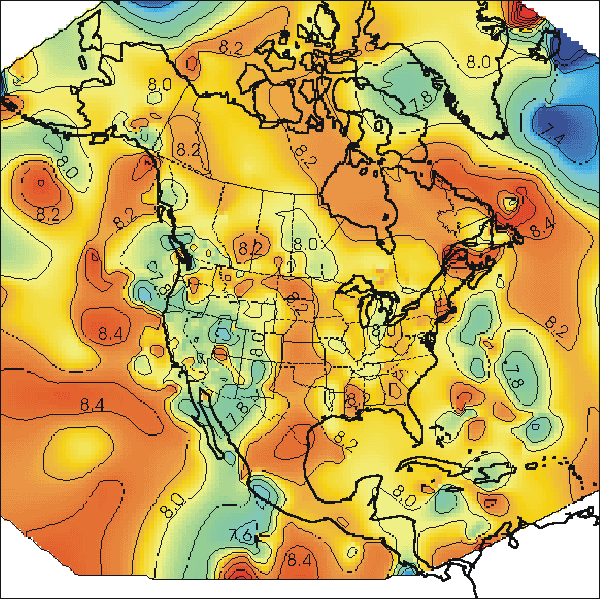
Figure 3. Map of sub-Moho p-wave velocity.
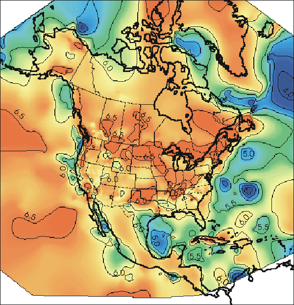
Figure 4. Average crustal p-wave velocity (Pc) of North America including the sediments.
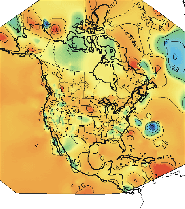
Figure 5. Average p-wave velocity of the consolidated or crystalline crust (Pcc) without sediments in North America.
Conclusions
A close correspondence exists between high average crustal velocity and accretionary and magmatic orogenies (e.g., Trans-Hudsonian, Grenvillian, Acadian, Appalachian, the Cascades, and the Alaskan Range). In contrast, there are a number of interesting anomalously low average crustal velocities in the Basin and Range Province, the Snake River Region, and the Northwest Territories of Canada. Many of these are regions of active or recent extension or hotspot activity.
Global Crustal Model
Find out more about current global models for the crust at Gabi Laske's CRUST 1.0 website: https://igppweb.ucsd.edu/~gabi/crust1.html